Brasília#
Brasília is capital of Brazil and seat of government of the Federal District with about 2,5 million inhabitants.
It is an artificial city, planned and developed by Lúcio Costa and Oscar Niemeyer in 1956 to move the capital from Rio de Janeiro to a more central location. The landscape architect was Roberto Burle Marx. The city's design divides it into numbered blocks as well as sectors for specified activities, such as the Hotel Sector, the Banking Sector and the Embassy Sector. Brasília was chosen as a UNESCO World Heritage Site due to its modernist architecture and uniquely artistic urban planning.
The city at the top of the Brazilian highlands in the country's center-western arid region. The Paranoá Lake is a large artificial lake that was built to increase the amount of water available and to maintain the region's humidity. It has Brazil's second largest marina, and hosts wakeboarders and windsurfers. Diving can also be practiced. One of the main attractions for divers is Vila Amaury, an old village submerged in the lake. This is where the first construction workers of Brasília used to live. The city has a unique status in Brazil, as it is an administrative division rather than a legal municipality like other cities in Brazil. One of the main objectives of the master plan was of the city was to allow the free flow of car traffic. The plan included lanes of traffic in a north-south direction (seven for each direction) in the Monumental Axis Leading to the lake and to the presidential palace. It also has three “arterials”, for the residential Axis. The main residential area was originally planned to consist of “superquadros”, apartment buildings arranged rectangular around a large interior space allowing for a pool, a small park, tennis court, etc. In a way they were supposed to act like small villages where everybody would know everybody and enjoy spare time together. When the author visited the first time in 1975 it was already clear that the idea was working less than half the time, in the other cases the apartment buildings were just living silos for anonymous families. The superquadros were planned to be at the end of cul-de-sacs to avoid through traffic. Indeed the original idea was to also avoid traffic lights by using roundabouts and other tricks to be discusses in a separate contribution. The emphasis of the plan on automobiles caused the lengthening of distances between centers and it worked only for the richer and small segment of the population who owned cars. This was indeed planned: A number of satellite cities were built at a distance of Brasilia, and workers were bused into the city at the beginning of a day, and back at the end of work.
When the author stayed in hotel near the central traffic node in 1975, the Rodoviaria, he was initially baffled by the line of buses passing nearby in the morning and evening, clearly carrying a huge number of people in a city that had then officially fewer than 400.000 people.
By now, new housing areas with small houses have been developed, elevated highways, bridges and of course traffic lights have much changed the original intentions. Yet a few of the pictures below will still give an impression of the original ideas.
The Juscelino Kubitschek bridge, also known as the 'JK Bridge', crosses Lake Paranoá in Brasília. It is named after Juscelino Kubitschek de Oliveira, former president of Brazil. It was designed by architect Alexandre Chan and structural engineer Mário Vila Verde. It consists of three 60 m tall asymmetrical steel arches that crisscross diagonally. With a length of 1,200 m it was completed in 2002. It has a pedestrian walkway and is accessible to bicyclists and skaters. Brasilia has also a metro system by now, connecting a number of satellite cities (many of them close to half a million inhabitants by themselves) to Brasilia. All pictures shown are either from the author H. Maurer, or from Pixabay.com. Most pictures are from after 2010, but a few are from 1975! All pictures are in the public domain.
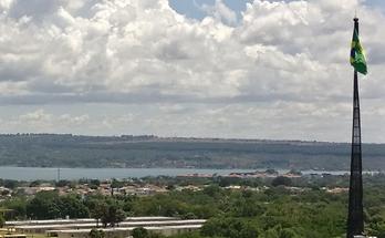 Lake
Lake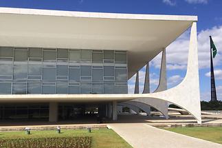 Palace
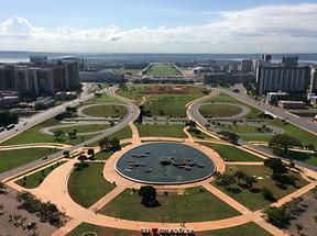 Main Axis of Brasilia
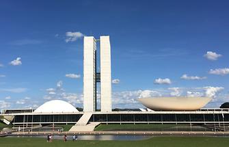 Parliament
 Lower House, Parliamant Brasilia
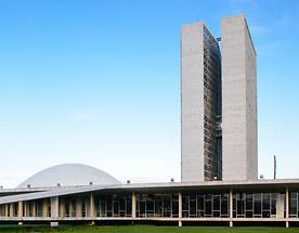 Upper House
- Government Building
- Sculpture (1)
- Sculpture (2)
- Cathedral (1)
- Cathedral (2)
- Bell tower
- Museum and Cathedral, Brasilia
- Cathedral - Guards
- Cathedral - Floating Angels (1)
- Cathedral - Floating Angels (2)
- Cathedral - Floating Angels (3)
- Blue cathedral (1)
- Blue cathedral (2)
- University access
- JK Bridge
- Violet Ipé
- Yellow Ipé (1)
- Yellow Ipé (2)
- Arid Landscape
- Lake Paranoá