Geoglyphs in Palpa Valley#
by Stanislav Sedov and Dmitriy Moiseenko,
members of the AirPano Team that is a member of the global-geography Consortium.
1 February 2012
with kind permission of AirPano
Nazca and Palpa lines. South America, Peru#
No one knows exactly what Nazca lines are. The only indisputable fact is that they are located in South America, at the Nazca Desert plateau in the southern part of Peru. They were added to the list of UNESCO World Heritage sites in 1994. However this is where the indisputable facts end, leaving the scientists with numerous unsolved mysteries.
Scattered around the plateau, the lines are gigantic geoglyphs representing geometrical and nature objects. They are carved about 135 cm wide and 40-50 cm deep in the ground. It is impossible to recognize an actual image from the ground level, as "one can only see the big picture from the distance". This is why the Nazca Lines were discovered only in 1939 when airplane flights have become possible.
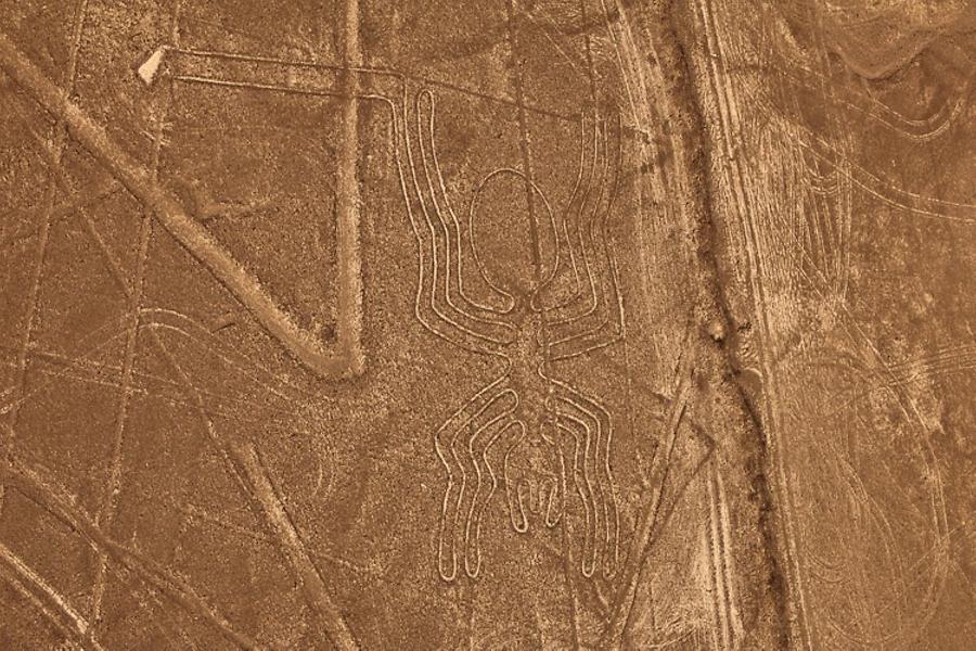
Ever since this time, year after year, many scientists have searched for the answers to "Who?" and "Why?" questions. The majority of them share an opinion that the lines were created by Nazca Civilization that flourished at the plateau prior to 200 AC, long before the Inca Civilization. But what purpose did the lines serve? The could be the world's largest astronomy calendar (although researchers have not yet figured out how it'd work); or they could serve as landing lights for alien spacecrafts just as well.
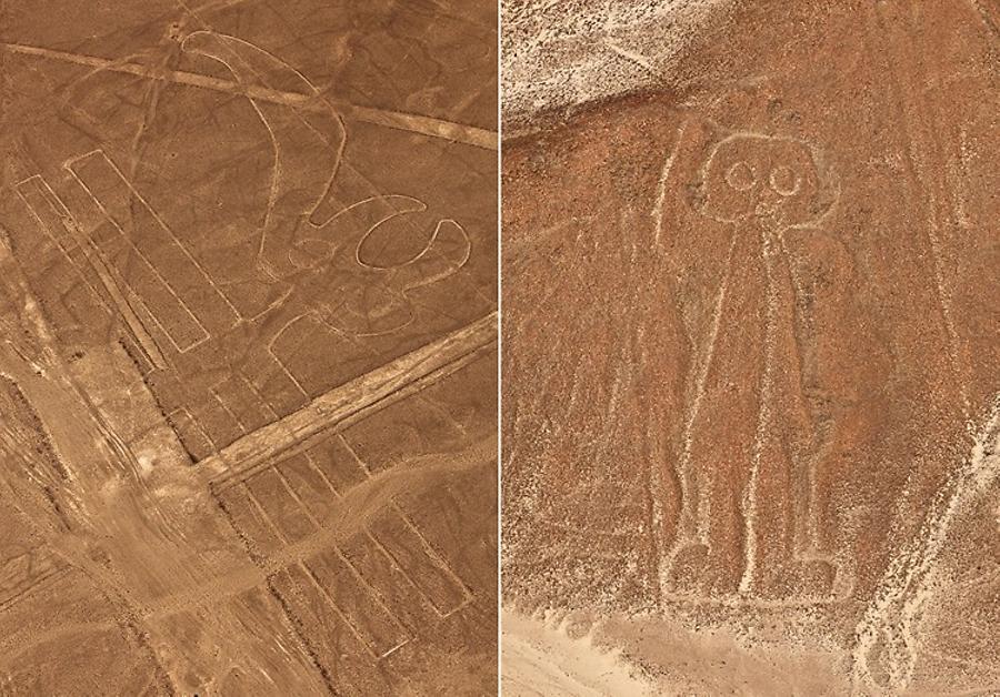
The themes of Nazca Lines have vary from flowers, geometric shapes, animals, and birds to even insects. The smallest figure is a 46-meter spider, and the largest — a 285-meter pelican...
At the end of 2011 two of our colleagues left for South America: the photographer Dimitriy Moiseyenko and the pilot of the radio-controlled helicopter, Stas Sedov. Their assignment was to photograph the lines in the Nazca and Palpa deserts of Peru; Machu Picchu, the ancient monument of Inca Civilization; and the Easter Island stone figures. You may find the virtual tour from Nazca desert here and now we present the photo coverage of their trip to Palpa.
Chasing the colibri bird
During our first day we figured out that the dessert couldn't be accessed neither by car, nor by foot. After speaking with policemen and security tower guards, we found out that the local Ministry of Culture was the only authority to grant special access permissions, and that they would issue it only to archaeological groups. In the past the access to the desert was absolutely unrestricted, and consequentially wheels of SUV cars destroyed a significant number of geoglyphs.
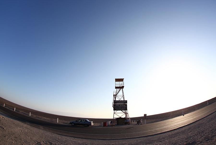
Local authorities built several observation towers for tourists. We found one of them right on the Pan-American Highway near Nazca, and another one — about 30 kilometers towards Palpa. Frankly speaking, the "tourist" view from the observation towers is not that great. It is by far more interesting to look at the figures from small airplanes flying over the desert from the local airport.
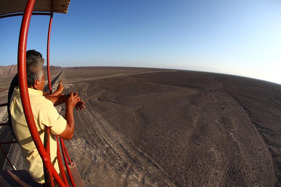
Our second day at Nazca got off on the wrong foot. Our plan was to go to the remote point near Palpa in the morning and then to go into the dessert and try getting closer to the figures. The observation site was empty yesterday — there were no tourists or security guards. We assumed that it would be empty at 6am as well. We were so naive...
We left at dawn, and here we were, standing at the observation area. Oh, what bad luck! Just a few minutes ago the coast was clear, and now there was a police jeep on the road: they seemed to appear from nowhere just about 400 meters away from us. It would be practically impossible to photograph now, since the figures were about 200-300 meters away from the observation site. We could fly there, but it would be very difficult to take quality photos.
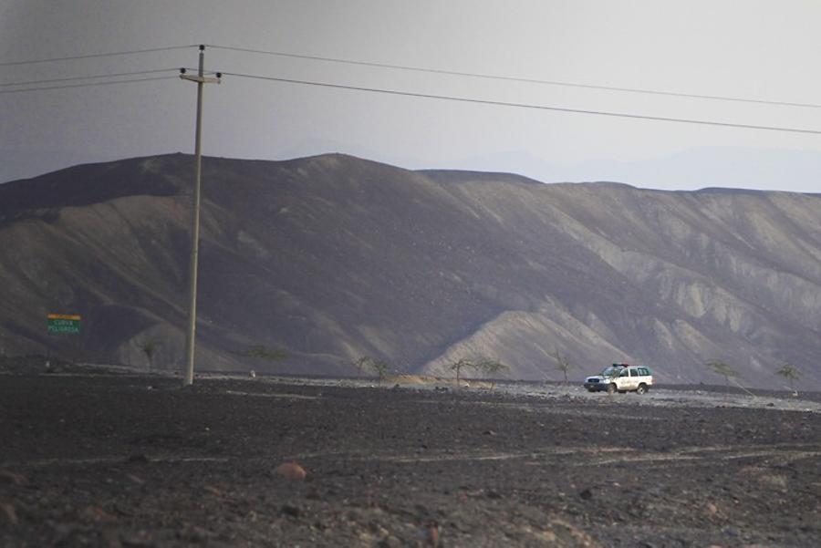
After a few minutes of brainstorming, we decided to give it a try and fly there. We made a couple of trial spherical panoramas, landed and realized, that we were out of luck today: all figures looked very small and far away. Oh well, we decided to make a deal with the police. We drove to the Jeep just to see a sleeping police officer. Trying not to wake up the guard on duty, we rushed back to our observation site. The following events occurred just like in a spy movie...
We picked up the equipment and started moving through the desert towards the figures. When we were half way there Dima noticed that the policeman was no longer asleep. Instead, he got out of the car and was watching us! It looked like we got busted! What should we do? Run? We opted for an unconventional approach and started shooting right in front of the policeman. We got up in the air, shot several spherical panoramas and landed, constantly glancing back at the policeman. There was no reaction. Maybe he didn't notice us? Hiding in the glens we came closer to the figures. The terrain was perfect for disappearing from the police patrol.
We started to fly actively, always expecting to hear shouting from behind our backs. In about half an hour I climbed up from another ravine just to find a completely empty road: the police Jeep drove away. Most likely we got lucky and he didn't notice us! So we continued working very close to the figures. We used up almost all helicopter batteries, saving a couple of charged ones for flying over the observation site near Nazca.
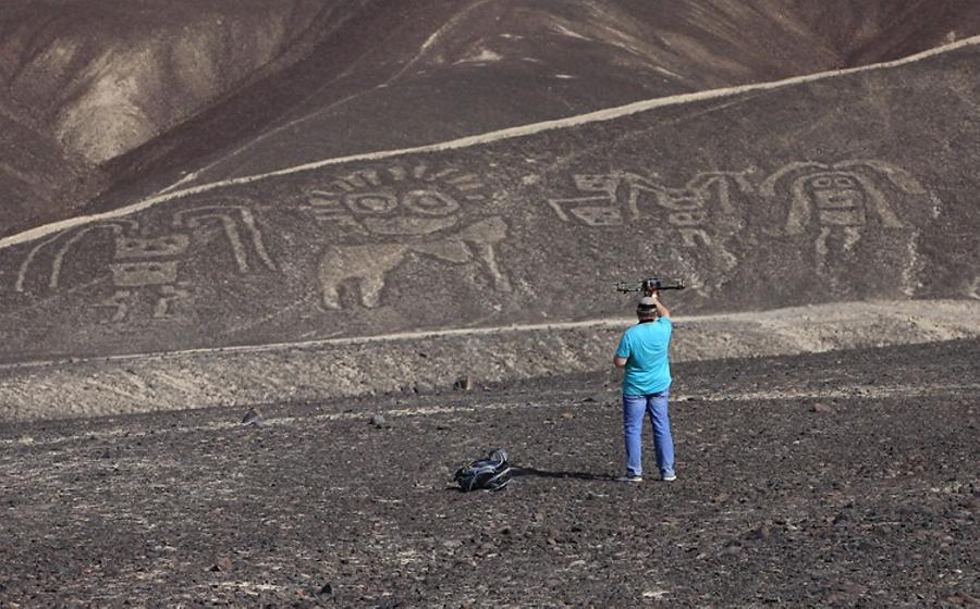
Tired, but very content, we returned to our car. At the very last moment Dima decided to take more pictures with his telephoto lens, and while changing the lenses, he left the car keys inside.
Now, we must say that the crime rate in Peru is quite high, so local car alarms are designed to lock the doors automatically if the engine is not started in a couple of minutes after you open the car. And once the engine starts, doors get locked right away.
As you can imagine, our car keys got locked in the car while Dima was taking pictures.
So, we were locked out in the dessert, within several hours of walking to the nearest village, and not a soul around. Our tools and water were in the car. All we had was the helicopter and the camera with a huge lens. We tried pressing down the windows — useless. After a couple of intents, I suggested to break a back door window. Dima's dramatic dilemma — to break or not to break — was documented, and now you can watch it here.
I quickly imagined the police discovering our lifeless dehydrated bodies next to the intact car, and strongly encouraged Dima to find a solution. And so he did! After giving it some thought he suggested that instead of the back window we should break a small back vent to reach for the keys. After searching the surroundings for a few minutes we found several pieces of steel wire (from a roof of the local "museum" that looked more like a bus stop), which Dima used to "fish" our keys from the car. We were saved!
On the way back to Nazca we took more pictures of the Tree and the Hands, and tried to photograph the Lizard. Security personnel told us how to find the local Ministry of Culture and so we decided to obtain the official permit for entering the desert.
The Minister-Archeologist was absent from his office when we came there in the morning. His secretary explained by gestures (because almost nobody speaks English there) that we'd have to return after lunch.
What should we do? Dima suggested flying over the desert on a small airplane. He wanted to photograph the figures, which were not accessible by foot, and I was supposed to film the process; but most importantly, I had to figure out the way to access one of the famous figures avoiding police cordons.
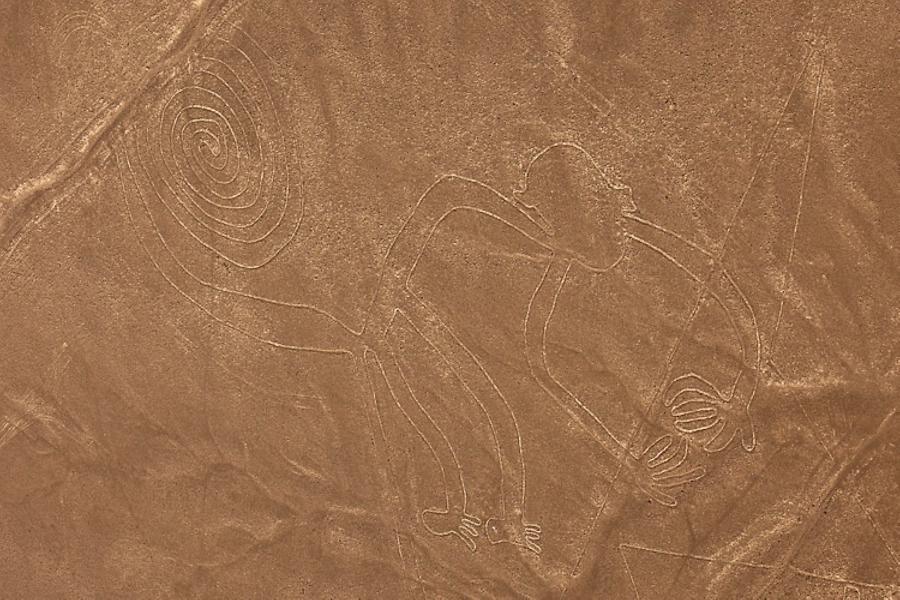
The flight. No, actually it was THE FLIGHT!!! Although I have a great flying experience, this gave me more adrenaline than flying a motorized hang glider. I'll skip the details of how we had to negotiate in the airport, and how later on they tried to cheat us on almost every point of our agreement.
So, the plane was at the lineup for take off. As our pilot started to play with the engine, adjusting the fuel mix, I realized what a great "entertainment" was in store for us. Surely, instead of stopping at the beginning of the runway, the pilot taxied further back onto the dirt road, trying to add another ten meters for the acceleration. The engine roared and our "Cessna" streamlined down the runway quickly increasing its speed. Lift off! However, it was not a quick take off. Instead, we started slowly climbing up, one meter per second: quite an unpleasant experience.
What makes flights over Nazca so challenging? It is a hot low-density air with strong winds blowing over the plateau. We often noticed tornadoes of various sizes in the desert. I even got one of those tornadoes on video during our take-off.
In a few minutes we were flying 600 meters above the desert. Here was the first figure — the Whale. If the second pilot (a girl) wouldn't point it out, I would miss it. Expecting to see large geoglyphs, your mind doesn't want adjust to their true size right away. This is why it's practically impossible to spot them. Unlike the figures, the lines and the trapezoids are clearly visible.
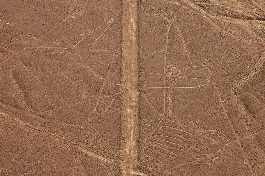
Getting closer to the next figure, our pilots took a sharp turn, making few circles and lurching at the most impossible angle. At the same time strong gusts of wind threw our plane from side to side. It felt like a rollercoaster, only several times stronger. It was amazing to see Dima leisurely hanging from the open airplane window, taking one picture after another with his telephoto lens, perfectly composing each frame...
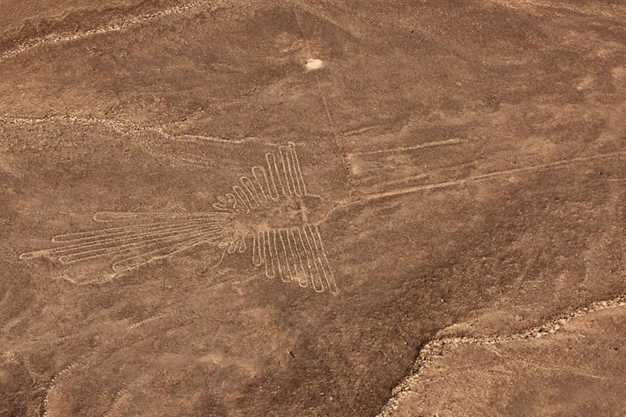
Dima recorded a GPS track during the flight, so we hoped that it'd help us find the Colibri rather quickly. After landing at the airport we tumbled out of the plane absolutely exhausted but reassured that one of the dirt roads could take us right to the Colibri figure. 50 minutes of our flight passed by unnoticed, if not to mention that my face went from being muddy-gray to greenish in color.
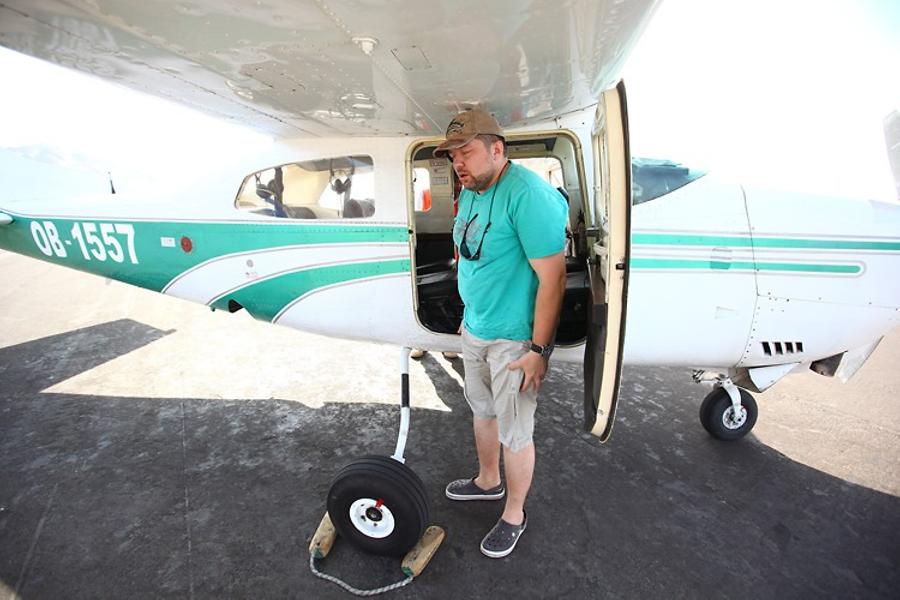
Another visit to the Ministry: it looked like the Archeologist never showed up in his office, so his secretary declared with a sigh: "Mañana", which meant: "Come again tomorrow". And so we decided to set off to our quest for the Colibri after a short break in the hotel.
This figure was located somewhat away from the main road. We chose to go in the evening, when touristic planes would have already finished flying. Except for the pilots, no one could really see us — I haven't noticed any activity in this area during our flight.
Our path to the mountains started off relatively easy, with a well-pressed dirt road. Unfortunately, I couldn't spot any particular landmarks during our flight so we had quite an emotional debate with Dima about which way to go and where to park our car. Dima kept showing me his GPS track and pointing to the opposite direction (from my point of view). I insisted on my choice of direction relying entirely on my visual memory, and just by a miracle I was able to persuade Dima (and by using some convincing words) to follow my lead.
According to our estimations, there was only 15-20 minutes of a daylight left. The time was pressing, especially taking into account that we didn't exactly know where to go.
We climbed up the mountain, heading towards the desert. As we got to the top I looked around and felt rather desperate: it wasn't the plateau, it was just one of the spurs on the way to it. We had to go 70 meters down a steep slope made of sand and stones, cross a valley and climb up about 100 meters more. We're not going to make it! Dima doubted that we could even descend there without breaking our legs. However, we pulled ourselves together and ran downhill, scattering stones...
Our ascent was a blur. I lost my energy somewhere halfway up the mountain: running at this elevation with the 15-kg backpack, the equipment hanging around my neck, and the helicopter in my hands was not the easiest task in the world. Dima took his camera out and shot a short video.
Five more minutes of ascending, and we were on the plateau.
We made it! So where is the figure? We checked the GPS track again: we should be very close, but there was nothing on the ground. We found some lines that looked like the Colibri tail... We brought the copter up and took some pictures. As soon as it landed Dima rushed to the camera. No, that was not the Colibri, it was a strange little "sun" and a huge landing strip for alien spacecrafts.
We kept on walking in the desert; the sun descended faster and faster. There was just a couple minutes left of the daylight. We came across another trapezoid or a line, and Dima said: "This place is called the Nazca Lines, so since we couldn't find Colibri, let's shoot the lines".
I flew the copter quite high and we shot a spherical panorama. Then Dima asked me to spin the helicopter around its axis, without shooting. I usually don't do that due to the limited flight resources, but this time I decided to go ahead. I really don't know why. I span off the helicopter despite of the strong wind and average visibility, and suddenly Dima yelled right into my ear: "COLIBRI!!! Shoot!!!
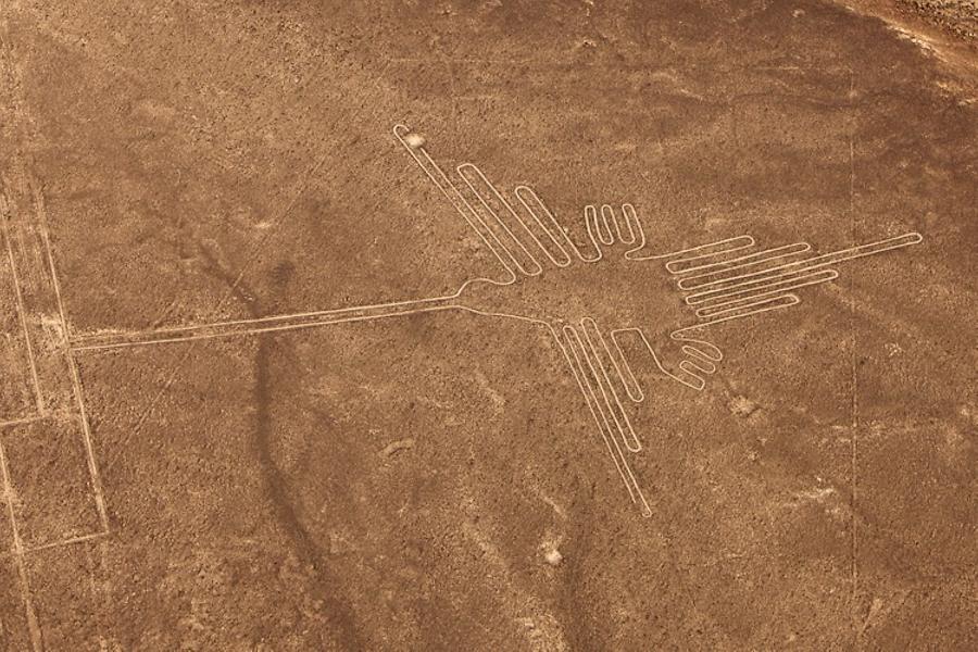
It turned out we were standing very close to this geoglyph (a very little figure, to be precise — the bird was very small), without even realizing it. Actually, it was clearly visible on the ground from a short distance.
The Nature awarded us with a fantastic sunset. We haven't seen anything like it in the past couple of days: clouds in the pink light, the moon casting its silver shadow... We almost forgot why we got here in the first place.
As we came to our senses, we made a couple of flights over Colibry, before the sun has completely set behind the horizon. It is hard to put in words the emotions we have experienced on this plateau. Apparently, those who picked the location for this "little bird" knew something beyond our comprehension. Or perhaps, we were just overwhelmed with positive emotions of our successful mission...
While I was packing our equipment, Dima ran around the figure in excitement, trying to shoot a documentary video and some ground-level photos.
One thought was pounding in my head on our way to the car: we must always keep on fighting, even when it seems that all is lost, that we didn't make it, that we didn't find it...
The luck favors the persistent.
6 Panoramas of Geoglyphs in Palpa Valley
9 Panoramas of Nazca Lines. South America