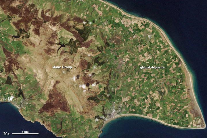
Northern end of the Isle of Man #

While most of the rocks are covered by soil, some rock layers exposed at the surface, along the coast, and in quarries have shed light on this islands assorted ancient landscapes. This natural-color satellite image of the Isle from 1 May 2001 shows the northern end of the island; the image has been rotated so north is to the right.
Croplands cover the relatively flat terrain of the northern coastal plain, which forms a rough triangle. Underlying the fields are glacial sediments. Between 70,000 and 10,000 years ago, a giant ice sheet covered the Isle of Man. The ice advanced and retreated multiple times, occasionally piling up rocks to form hills.
As the ice melted, all the dirt and debris locked within it came to rest on the northern plain. Toward the south, the land rises. The rock layers in this region are collectively known as the Manx Group; they make up the bulk of the Isle of Man, and comprise a mixture of sedimentary and volcanic rocks, folded and faulted by millions of years of tectonic pressures.
They are far older than the glacial sediments coating the northern plain, having been formed between 490 million and 470 million years ago at the bottom of an ancient sea floor. Visible from the sky, the uneven contours of these rock layers hint at their complicated history.