French Polynesis. Part IV. Rangiroa#
Photos and text by Ádám Plézer,
member of the AirPano Team that is a member of the global-geography Consortium.
20 January 2021
with kind permission of AirPano
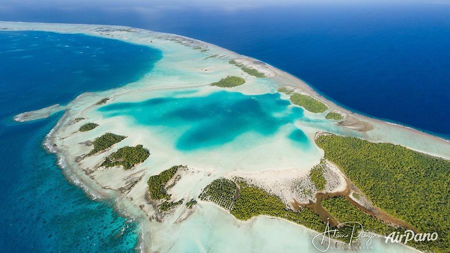
Rangiroa, French Polynesia
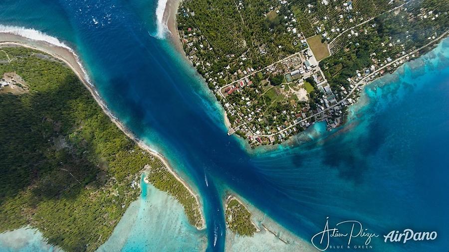
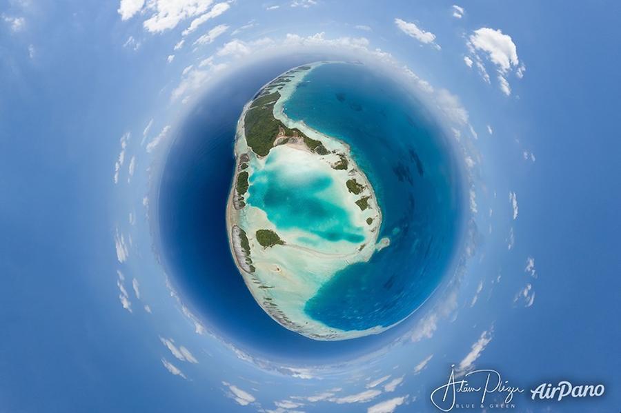
Rangiroa (Tuamotuan for 'vast sky') is the largest atoll in the Tuamotu archipelago and one of the largest in the world. The atoll consists of about 415 motus, islets and sandbars comprising a total land area of about 170 km². There are approximately one hundred narrow passages (passes), called hoa, in the fringing reef. The lagoon has a maximum depth of 35 m and it is so large that it has its own horizon. Due to its shallow depth, the currents that come in and out through the passes and with the winds can sometimes create interior storms.
© AirPano
This indeed happened on my catamaran trip when we had one and a half meter high waves within the lagoon. This made it very difficult when we wanted to pack all the photographic gear from the catamaran into our rubber dingy, or when we wanted to get back on board. But these waves were very much fun to ride with the boat, just like surfers ride with their boards the waves, you can do the same with an engine propelled dingy, provided you have an expert and crazy captain, Teahui, like I did.
When I tell my friends about Rangiroa and other Polynesian atolls, they often ask me what is exactly an atoll. In 1842, Charles Darwin explained the creation of coral atolls in the southern Pacific Ocean based upon observations made during a five-year voyage aboard HMS Beagle from 1831 to 1836. Accepted as basically correct, his explanation suggested that several tropical island types: from high volcanic island, through barrier reef island, to atoll, represented a sequence of gradual subsidence of what started as an oceanic volcano. He reasoned that a fringing coral reef surrounding a volcanic island in the tropical sea will grow upward as the island subsides (sinks), becoming an "almost atoll", or barrier reef island, as typified by an island such as Aitutaki in the Cook Islands, and Bora Bora and others in the Society Islands.
© AirPano
The fringing reef becomes a barrier reef for the reason that the outer part of the reef maintains itself near sea level through biotic growth, while the inner part of the reef falls behind, becoming a lagoon because conditions are less favorable for the coral and calcareous algae responsible for most reef growth. In time, subsidence carries the old volcano below the ocean surface and the barrier reef remains. At this point, the island has become an atoll.
Atolls are the product of the growth of tropical marine organisms, and so these islands are found only in warm tropical waters. Volcanic islands located beyond the warm water temperature requirements of hermatypic (reef-building) organisms become seamounts as they subside, and are eroded away at the surface. An island that is located where the ocean water temperatures are just sufficiently warm for upward reef growth to keep pace with the rate of subsidence is said to be at the Darwin Point. Islands in colder, more polar regions evolve toward seamounts or guyots; warmer, more equatorial islands evolve toward atolls, for example Kure Atoll.
© AirPano
The atoll formation can be followed on the example of many islands in Polynesia: Tahiti is a relatively young volcanic island. You see everywhere the black sand on its shores and the whole shape of the island is that of a classic volcano. Yet the formation of the reef can already be seen: at most places Tahiti is surrounded by a fringing coral reef. At some locations this reef has an opening, a so called "pass". These passes form always opposite locations where little rivers or creeks flow into the sea. The freshwater content is not tolerated well by the reef building creatures, so an empty space remains and it serves also as a channel out to the open ocean. Lucky for boats!
© AirPano
After many millions of years, the erosion wears down the central part of the island, and you get an island like Bora Bora. Even later you will have a formation like the Gambier islands, which are actually the remnants of one big volcanic island, a sort of huge Bora Bora torn apart into fragments. Even later the central part of the island disappears completely, after 50-60 million years. All is left will be the necklace-like ring of the outer coral reef. Just like Rangiroa, which is one of the biggest such atolls in the world. Hard to imagine that there used to be a majestic volcano where we are now riding the waves of the inner lagoon. Rangiroa preserved its two main passes: Tiputa pass and Avatoru pass. These are the locations where major rivers used to flow out. And of course these are the places where water masses can commute between the lagoon and the open ocean. Entering Rangiroa's lagoon during the phases of incoming high tide or exiting low tide is always a dramatic experience. Massive currents and cresting waves are not for the faint hearted.
© AirPano
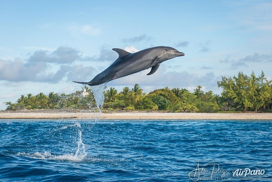
Rangiroa offers some of the best dives in the world in and around the Tiputa Pass, which lies at one end of the one main road and runs 3.5 km to the Avatoru Pass. Sedentary common bottlenose dolphins (Tursiops truncatus) regularly play group in the Pass. They can be viewed from the mainland but it is also one of the few places where they can be approached in scuba diving.
© AirPano
Because of its large size and the existence of only two passes, each high tide creates a strong incoming current while each low tide creates a strong outgoing current in those two passes. When the current is flowing inward through Tiputa Pass, about 200 shark specimens gather at the entrance to the Tiputa Pass, at fifty meters deep. Led by the strong current, sharks can remain motionless and allow divers to observe them without any difficulty. Large manta rays, green sea turtles, and humphead wrasses can also be seen. Occasionally, tiger sharks and hammerhead sharks can also be spotted. In January, large number of stingrays gather in the Tiputa Pass, as well as hammerhead sharks that feed on them.
© AirPano
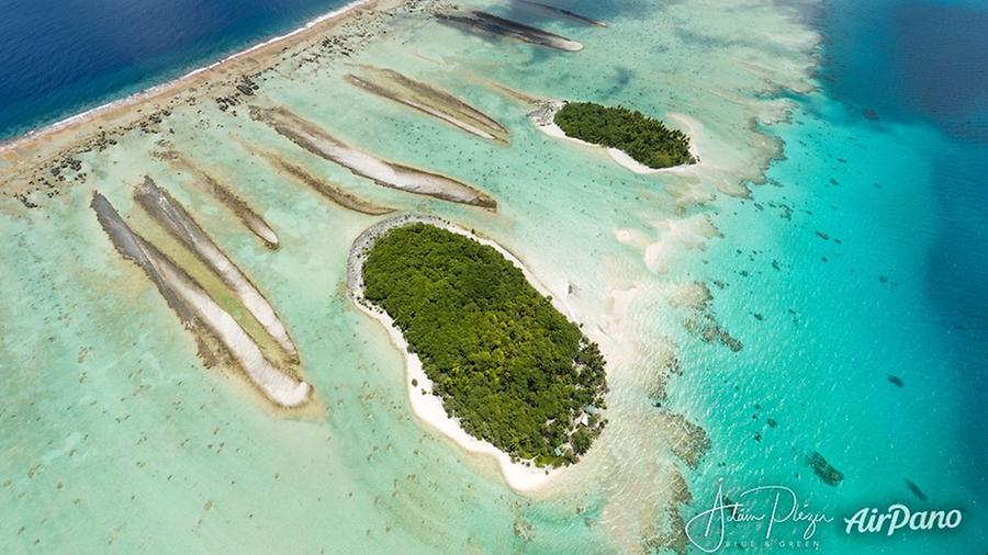
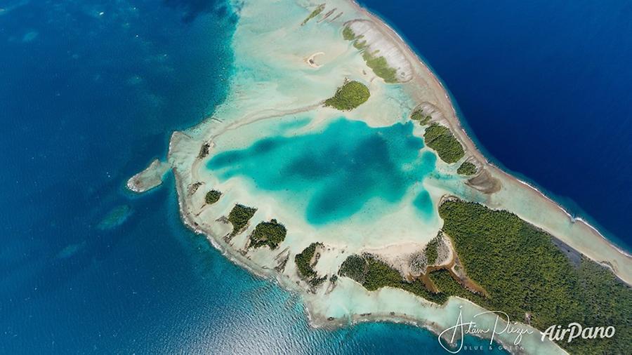
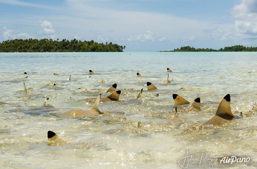
A notable site in the atoll is the famous Blue Lagoon, which is a smaller lagoon formed on the southwestern edge of Rangiroa. Its shallow waters accentuate the bright blue color of the water. It serves also as shelter to many juvenile blacktip sharks.
© AirPano
9 panoramas of French Polynesis. Part IV. Rangiroa