Sakhalin Island#
by Sergey Rumyantsev,
member of the AirPano Team that is a member of the global-geography Consortium.
8 October 2015
with kind permission of AirPano
"The edge of the world... Where can it be?" Probably everyone thought of that once. And everyone had their own thoughts on this question. When I was a child I liked a song about Sakhalin which said: "And I am throwing rocks from a steep beach of the faraway La Pérouse strait". I imagined the steep cliffs, the endless sea... and that place was the edge of the world for me. That was the place I wanted to go to. So here we are, many years later I am on my way to Sakhalin hoping to see this mysterious La Perouse Strait.
The weather forecast was nice and the mood as perfect. However, when the airplane started to descend we could see a vast thick cloudiness under us and just before landing the bald peaks surrounding the South-Sakhalin Khomutovo airport appeared. It was raining. The girls from the Ministry of sport and tourism that where meeting me at the airport said that the weather forecast suddenly changed to bad so our helicopter photo shoots are delayed. We had a week scheduled for our journey so I wasn't very emotional about that. I had time to take a slow walk around the city, visit the Regional natural history museum that was located in a Japanese building, built in the traditional national style. And, of course, I certainly had to taste the Japanese cuisine, which was absolutely marvelous.
One of the main tourist sights of South-Sakhalin is the "Mauntain air" mountain skiing resort. Almost half of the year it's slopes are covered with skiers from all over Russia. In summer you can use the ropeway to reach the top station and breathe in the pure mountain air, wander the various forest paths, what I certainly did.
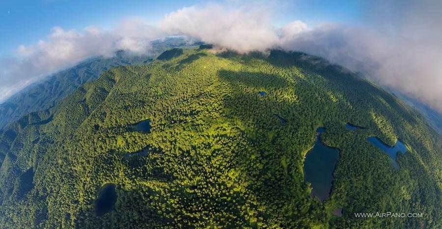
Days past and tough the rain stopped, the low cloudiness prevented me from performing the first flight. I got nervous more and more. And when there were only two days left the Sun came out on Yuzhno-Sakhalinsk. The equipment had already been prepared, so some short negotiations with the heli-pilots and I was on my way under the evening sun to the Shlamberg mountain and the unique high-mountain lakes near its top. After five days of rain nature granted me the fantastically beautiful light. Big clouds sparkled and reflected in the smooth waters of the high-mountain lakes. Covered with green tress the plush bald peaks appeared under the helicopter. How beautiful it must be here in autumn!
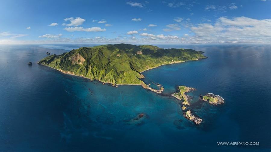
I hoped that the weather won't go bad and the flight to Moneron Island would happen on the next day. It is Russia's first marine natural park which is rightfully considered one of the pearls of Sakhalin region. It is very hard to get there because it is situated near the state border line. It is necessary to obtain permissions from the Federal security service for going there and a separate permission to take photos there.
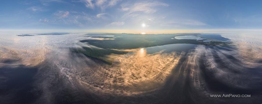
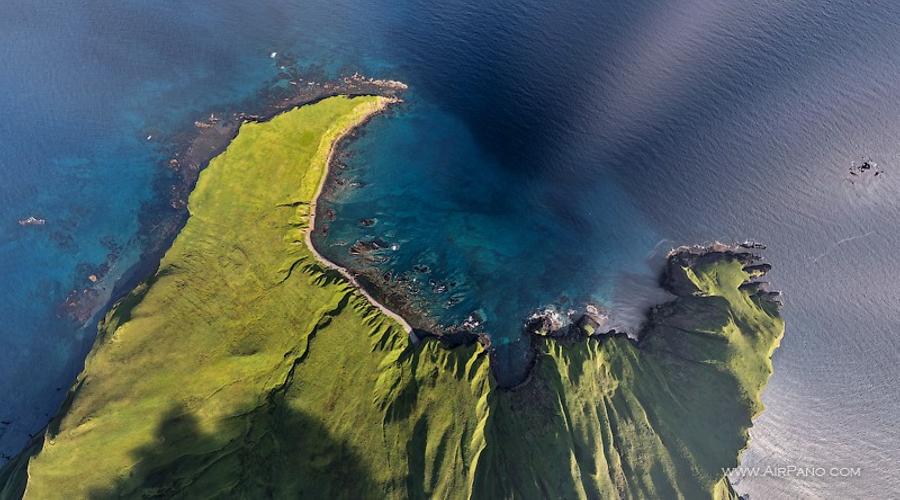
The morning saluted me with absolutely no wind. All permissions were obtained and here we are on our way to Moneron flying over the pink flat waters of the Tatar Strait. Moneron island is situated 43 km from Sakhalin. It is a small dot on the map with a total space of 30 square kilometers. Nevertheless, the island has its own world: two rivers, waterfalls, emerald hills, column cliffs, colored wall caverns, eared seals and sea lions swimming in absolutely unreal clear emerald water. Moneron stands in the way of the warm Cesium stream, therefore, the water there is not only transparent, but very war also — a real heaven for divers. In 2008 a tourist complex was established on the Island and divers in particular have become its constant visitors.
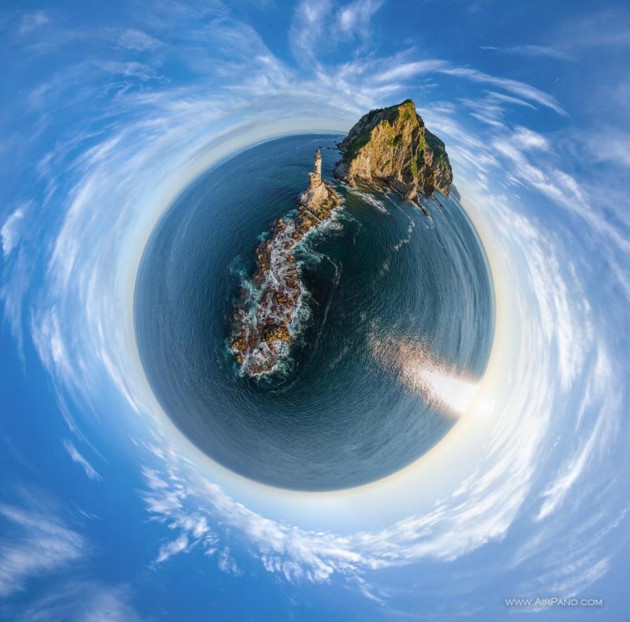
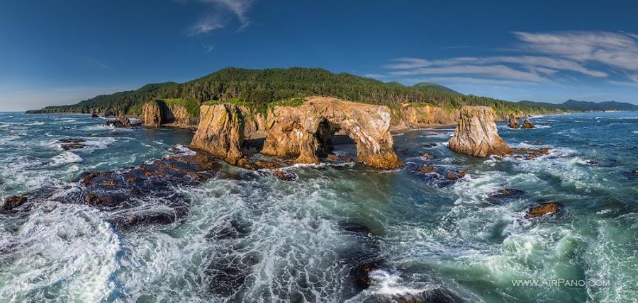
You can fall in love with Moneron from first sight easily. The green hills, clean and clear coves, astonishing cliffs — I was lucky to have seen this beauty from a birds-eye view. Unfortunately, there is no helicopter fuel depot on the Island, therefore, the aerial photo shoots were very limited, but I didn't lose hope. The Island's staff organized a boat trip around it for me. Warm weather, calm sea water, eared seals and sea lions enjoying the sun, great cliffs and caverns, seagull and loon chatter — this day was definitely the best of my Sakhalin journey.
Moneron opened its beauties to me, but I still haven't found the "Edge of the world", the a steep Sakhalin rocks of the La Pérouse strait hadn't revealed itself to me yet. I had only one more morning left before my departure. At 06:00 AM the helicopter was covered with fog and I feared that the flight would be cancelled, but, nevertheless, we took off and one hour later were near the Aniva cape — the south point of the Sakhalin Island. The "Edge of the world" appeared to be exactly as I imagined it — hard to get to and cliffy. This scenery in reality was complemented with a beautiful lighthouse built in 1939, but unfortunately it had been out of service long ago.
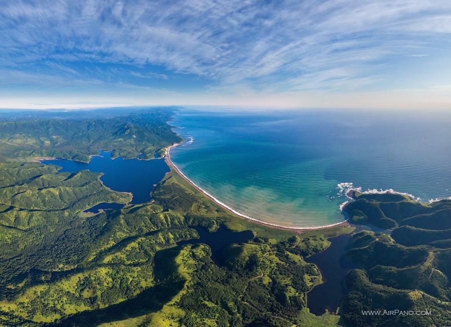
The way back lay through the shore of the Okhotsk Sea. The eastern coast of South Sakhalin left a strong impression in me: the Aniva cape, "Ptichye Lake", the cliffs at cape "Velican" — all of this can be observed by you through our panoramas.
We express our deep gratitude to the Ministry of Sport and Tourism of the Sakhalin region and to Atnon Zaytsev personally for the arrangement of the photo shoot.
14 Panoramas of Sakhalin_Island