Syr Darya#

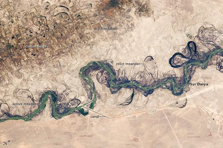
An older floodplain appears as more diffuse dark vegetation (image upper left), where relict bends are overlain by a rectangular pattern of cotton fields. The straight channel of a new diversion canal can be seen along the east bank of the river. Half the river flow is controlled from reservoirs, and half from direct water take-off from canals.
In contrast to the intensive agricultural use of water shown here, water control in the mountain valleys upstream is oriented more toward power generation. The river flows for 2,200 km (1,370 mi), from the Tien Shan Mountains west and northwest to the Aral Sea.
Control of the river is vested in the Syr Darya Basin Water Organization, run by nations with territory in the watershed. Some of the organizations main efforts include accurate gauging of water use and repair of canals to reduce widespread water leakage.