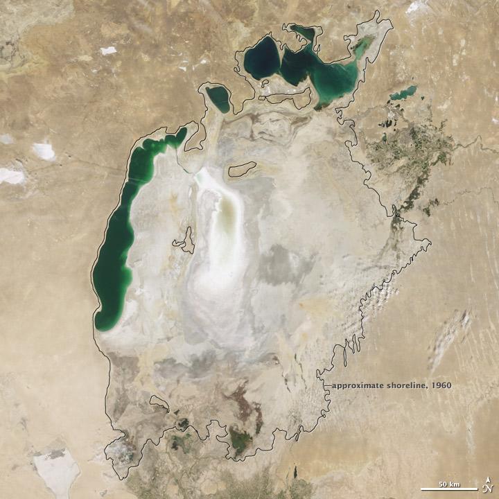
Aral Sea, dropped water levels#

As its water levels dropped, the lake began splitting into smaller pieces: the Northern (Small) Aral Sea and the Southern (Large) Aral Sea. The Southern Aral Sea further split into eastern and western lobes. In August 2009 when this photo was taken, the Northern Aral Sea (upper right) still appeared healthy, the Southern Aral Sea consisted of two isolated water bodies: an irregular oval shape directly southwest of the Northern Aral Sea, and the long, thin remainder of the Southern Aral Seas far western lobe.
Much of what finally doomed the Southern Aral Sea was an attempt to save its neighbor to the north. In 2005, Kazakhstan built the Kok-Aral Dam between the lakes northern and southern portions to preserve water levels in the north. The Northern Aral Sea actually exceeded expectations with the speed of its recovery, but the dam ended prospects for a recovery of the Southern Aral Sea, which some authorities already regarded as beyond help.
Lake sediments from this depleted water body have provided ample material for frequent dust storms.