Lencois Maranhenses National Park#
by Stas Sedov and
Dmitry Moiseenko
members of the AirPano Team that is a member of the global-geography Consortium.
8 August 2014
with kind permission of AirPano
Lençóis Desert is the farthest place that we have traveled from the Airpano.com hometown during our photo expeditions. The images that we took were "shelved" for almost 2 years, and now the time has come to publish them. It is an interesting and, in its own way, unique place.
The Lençóis Desert is located on the equatorial part of Brazil. Due to the high amount of rainfall per season, freshwater lagoons cover the desert. Let me show you the photograph of our photo crew (Dima Moiseenko, our guide, and myself) from up above to give you an idea of the size of the sand dunes.
The Lençóis Desert is a national park where all motorized transportation is prohibited. Drivers pick tourists up from the nearest settlement (about 30 kilometers away) and drive them along a very difficult road that goes through a thick bush, fording small rivers along the way. The Toyota Land Cruiser is the king of these roads — one can hardly find a car of any other brand here.
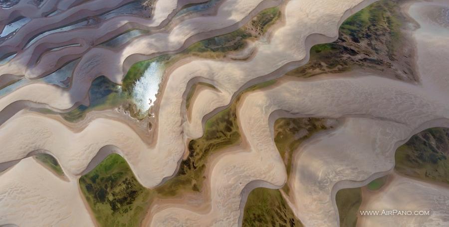
The tourists get off at the edge of the desert. Local guides recommend that visitors take off their shoes and walk barefoot in the sand. The sand is very fine and well pressed, so it is a pleasure to walk on! There are practically no thorns, rocks, or poisonous creatures in the Lençóis Maranhenses National Park, so the risk of hurting your feet is close to none.
The guides usually take tourists along the trodden path at the very edge of the desert, but it was not suitable for our photo shoot: strong winds are rare here; footprints remain on the sand for a long time, and so the nearest dunes were rather trampled. I believe that this is the main reason why they don't allow cars in the desert.
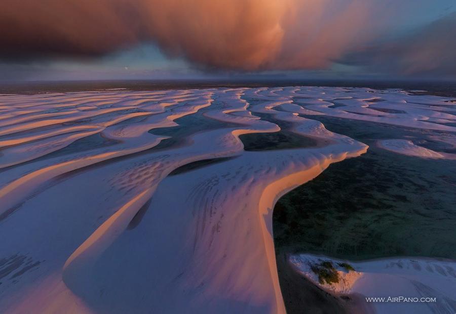
We asked our guide to take us further away from the trodden path. We took a few shots on the way and then got caught under a heavy tropical rainfall, which soaked us completely in just a minute. Our clothes dried just as fast. However, our equipment didn't recover that well: the helicopter's engine refused to start. We had no way to fix it as all our tools were left in the hotel room over an hour drive away. Yes, we were still inexperienced at that time, and so we found ourselves in tight spots such as this on a regular basis. Therefore, we had to bite off the insulation cover on the malfunctioning engine controller, clean it with a lens dust blower and dry it in the sun, and — bingo! The helicopter came back to life.
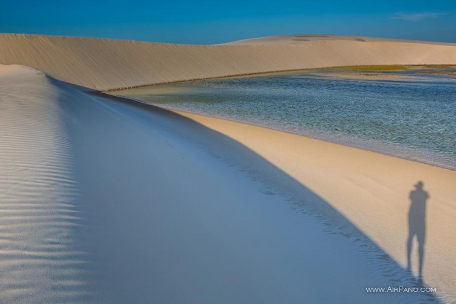
In the evening Dima and I went to photograph the desert without our guide. There were no landmarks or pointers, so we measured the distance depending on our walking time. We told our guides that we would return when it was dark because we wanted to shoot the sunset. We found a spot suitable for the shooting within about an hour and a half of hiking. I got an impression that the edges of the desert were still not very far away, as the scale of the dunes are not obvious without something to compare it to.
While waiting for the evening light, we swam in the lagoons: the water was sweet, clear, and warm and not a soul was around for kilometers. What bliss! Finally, the sun started its rapid descent into the horizon.
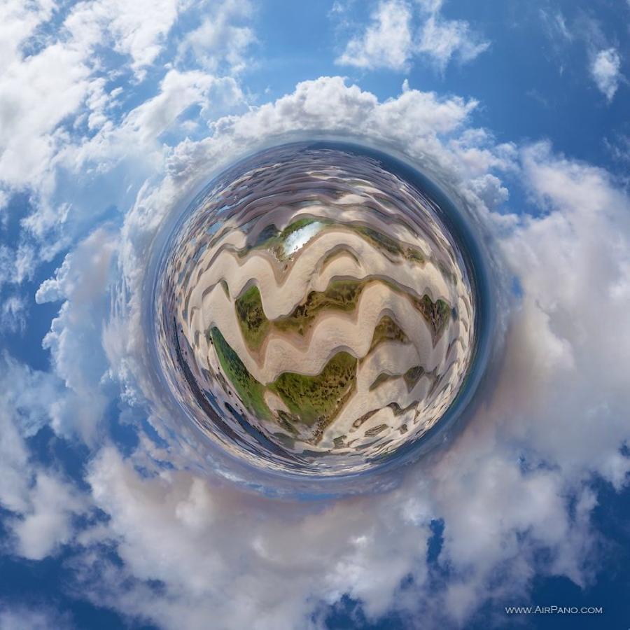
Darkness fell immediately after the sunset. To be honest, I was quite nervous, because Dima's iPhone (with our recorded trek) was the only navigation system at our disposal. We knew through our own experience in the Naska desert in Peru how easy it is to get lost even with a recorded trek in hand.
We lost our footprints very quickly and followed the general direction as we made our way back. Our guides did well: in about a half an hour after the sunset, they brought their car up on a dune and turned on the headlights. It worked like a beacon, making our navigation much easier, and so in about an hour we were on our way back to the hotel, exchanging our thoughts and memories of the day.
Will I be able to return to this place once again? I don't know, but I would surely take a future opportunity to do so!
The Lençóis Maranhenses National Park (Parque Nacional dos Lençóis Maranhenses), one of the main natural landmarks of the country, is located in northeastern Brazil. This is not a conventional park — despite abundant rain, there is almost no vegetation. A flat surface occupying about 1,500 square kilometers is covered with large sand dunes reaching up to 40 meters in height. The local people call the Lençóis Desert "a white bed sheet": the sand made of shiny white quartz, and the landscape formed from the winds blowing from the Atlantic Ocean can be compared to an unmade bed.
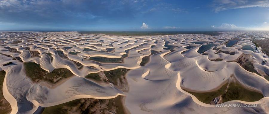
During the rainy season (which peaks between July and September) rainwater collects between the dunes, creating lagoons with an amazing variety of colors: all shades of blue, turquoise, and green.
Despite the fact that lagoons completely disappear during the dry season, every year there is fish in some of the water basins. There is no clear explanation to this. Perhaps, birds bring fish roe from the sea. One of the species of fish, the wolf fish (Hoplias malabaricus), stays dormant in the wet areas of the dunes even after the lagoons dry out. It may sound absurd, but there are so many fish in the Lençóis Desert that fishing is the main occupation for local people!
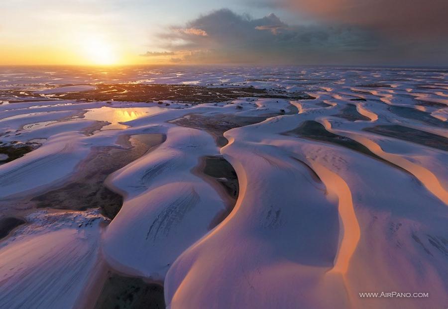
The sand formations and lagoons of the Lençóis Maranhenses National Park are a rare geological phenomenon that have been in the making for thousands of years. Because of the unique nature of the park's dunes, the desert can only be approached by foot, and only the aerial view will give you the most complete picture of this unusual landscape that resembles huge snowdrifts. You will have the opportunity to do so through our panoramas.
12 Panoramas of Lencois Maranhenses National Park