Chad-3: South Sahara. Sands and Oases#
Photos by Dmitry Moiseenko,
member of the AirPano Team that is a member of the global-geography Consortium.
14 October 2020
with kind permission of AirPano
The largest hot desert in the world, the Sahara, covers large parts of Algeria, Egypt, Libya, Tunisia, Mali and many other African countries — nearly a dozen in total. To the south, there is the country of Chad. Several AirPano tours have already been dedicated to the natural beauty of this country and now we invite you to have a look at landscapes of its famous desert!
© AirPano
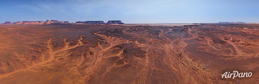
Rocky areas alternate with sand mounds occasionally covered by plants such as Tamarix, Acacia or Alhagi. Huge sand dunes form a kind of a sea with sand whirling in round, star-like, cross-sectional and crescent "waves".
© AirPano
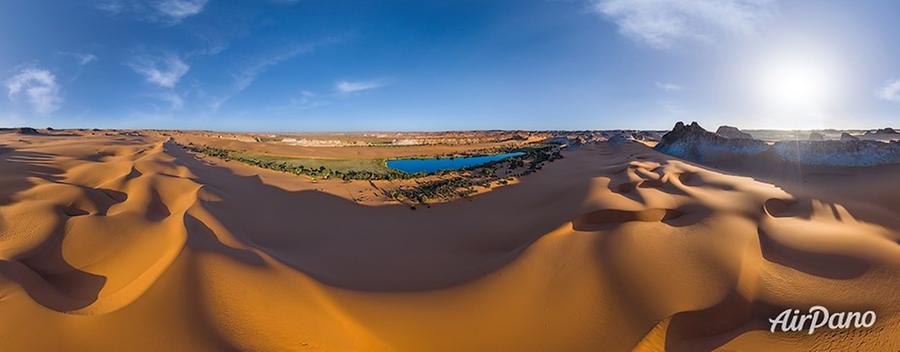
Oases form a bright contrast to the desert silence. The most known one is the oasis around the Lakes of Ounianga. The shores are covered by palm groves, the waters are full of fish and local people grow delicious fruits and vegetables irrigated by the water taken from the lake.
Video by Andrey Andreev
18 Ounianga Lakes covering around 20 km² were inscribed as a UNESCO World Heritage Site for its uniqueness. Some of the lakes are fresh, others are saline or hypersaline. These lakes form a hydrological system, replenish their supplies from groundwater sources and feed off each other.
© AirPano
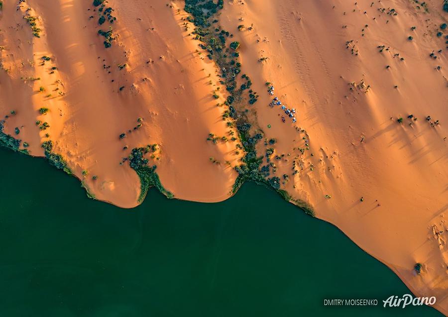
The largest of the group, Lake Yoa, covers an area of 3.5 km² and is 27 meters deep. Its highly saline waters only sustain algae and some microorganisms. Its surface evaporates a 6-meter layer of water annually but its "neighbours" manage to restore this amount of water.
© AirPano
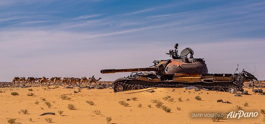
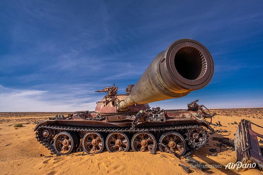
There are some man-made landmarks in this part of the desert, too, and rather unusual ones. In the 1970s and 1980s, these lands were the subject of military operations between Chad and Libya. The army of Gaddafi possessed modern soviet weapons of that time, such as the helicopter Mil Mi-24, fighter aircraft MiG-23, air defence complexes, T-55 main battle tanks and BMP-1. Chad, in its turn, was supplied by France and creative Frenchmen found the way to reduce the expenses. Instead of tanks, they supplied Toyota Hilux pickups. This car gave the name to the final stage of the conflict: the Toyota War. An incredibly manoeuvrable pickup truck was actively used by the Chadian troops for rapid movement on sand dunes while the body was equipped with an anti-tank gun. Awkward tanks of the Libyans couldn't control the movements of pickups and finally, the tanks were destroyed.
© AirPano
The war ended in 1987 and tanks remained in the sands forever. This kind of an open-air museum is the reminder of the military actions of the past.
© AirPano
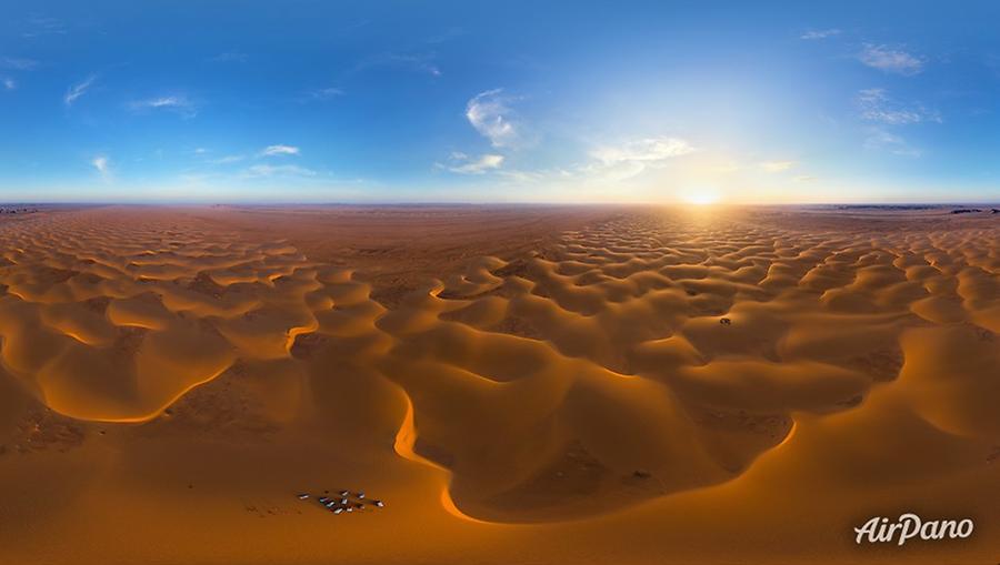
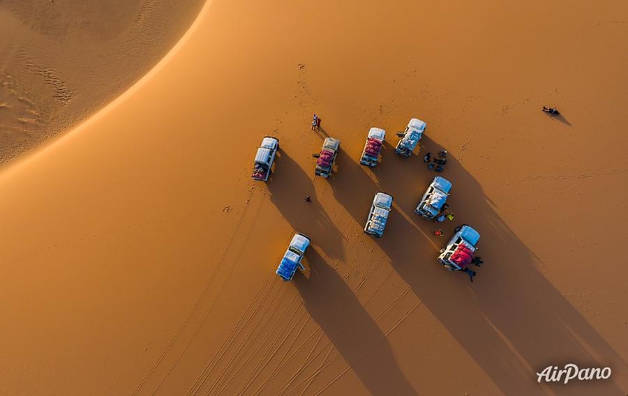
We started telling you the story about the Sahara with a reference to its hot climate. Most of the desert has more than 3,500 hours of sunshine per year and it's not just sunshine but furious burning rays. Just to compare: the average annual sunshine hours in Moscow is 1,731, in New York — 2,680. In the Chadian Sahara, there are areas with less than 30 mm of annual precipitation and an average temperature of +35...+42 °C. This is a very uncomfortable place for travelling but this AirPano virtual tour will allow you to visit this unusual corner of our planet with no inconveniences!
© AirPano
11 panoramas of Chad-3: South Sahara