Island, Cyprus #

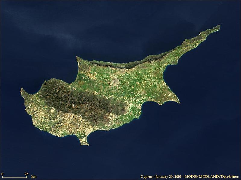
In the central and western part of the island is the Troödos Massif, a mountain range whose surface layer is mostly basaltic lava rock, and whose maximum elevation is 1953 m. Running in a thin arc along the northeast margin of the island is Cyprus second mountain range, a limestone formation called the Kyrenia Range.
A flat area of low relief occupies the space between these ranges, and is home to Nicosia, the capital city of the Republic of Cyprus. The city is visible as a grayish-brown patch near the center of the image. Nicosia lies along a UN-patrolled cease fire line that begins in roughly the center of the W-shaped northwestern coastline and meanders eastward across the island.
The line - established in 1974 - divides the Turkish-occupied North from the Republic of Cyprus to the south.